


In an ambitious endeavour to combat global warming, tech behemoth Google has announced its collaboration on a satellite project set to launch in March to map methane emissions worldwide. This innovative initiative, a partnership with the Environmental Defense Fund, seeks to leverage advanced technology to identify and mitigate one of the most potent greenhouse gases affecting our planet.
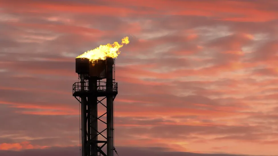
Methane, a gas that significantly impacts global warming due to its ability to trap heat, has been a growing concern among scientists and environmentalists. Predominantly produced by farming and waste disposal sectors, methane’s contribution to the greenhouse effect is second only to carbon dioxide. However, this project will hone in on emissions from a specific source: oil and gas plants, where methane is often released through practices like flaring and venting.
The satellite will gather crucial data on methane levels worldwide, orbiting 300 miles above the Earth 15 times daily. With cutting-edge artificial intelligence tools, Google plans to process this data to create a comprehensive methane map. This map aims to pinpoint leaks in oil and gas infrastructure globally, providing a valuable resource for tracking and addressing environmental concerns. Despite the potential to identify significant leaks, Google has stated, “Our job is to make information available,” leaving it to governments and regulators to enforce necessary changes.
The lack of international regulations targeting this greenhouse gas underscores the urgency of addressing methane emissions. Although the European Union has taken steps towards mitigation, including proposals to repair leaks in the oil and gas sector and ban flaring in coal operations by 2025, global efforts still need to be completed.
Google’s initiative has precedent. The European Space Agency’s Tropomi mission, launched in 2017, similarly tracks atmospheric trace gases, including methane. However, limitations such as cloud cover have restricted the effectiveness of existing tools. Google’s project aspires to “fill gaps between existing tools,” offering more comprehensive coverage and insights into global methane emissions.
The implications of unchecked methane levels are profound, with NASA reporting a doubling of atmospheric methane in the last 200 years, mainly due to human activities. Agriculture, particularly livestock farming, is a significant contributor, with billions of cows worldwide producing substantial amounts of methane through digestion.
As the world grapples with the escalating challenges of climate change, Google’s satellite project represents a critical step forward in utilizing technology for environmental stewardship. By providing actionable data, this initiative advances scientific understanding and empowers global efforts to curtail one of the most insidious contributors to global warming. As a Maynooth University professor, Peter Thorne notes, “Satellites are great for finding the huge, massive culprits” of methane emissions, highlighting the pivotal role of technological innovation in environmental conservation.
Google’s foray into environmental monitoring via satellite technology marks a significant milestone in the fight against global warming. By mapping methane emissions with unprecedented precision, this project offers hope for a more sustainable future, demonstrating the critical role of technology in addressing the planet’s most pressing environmental challenges.